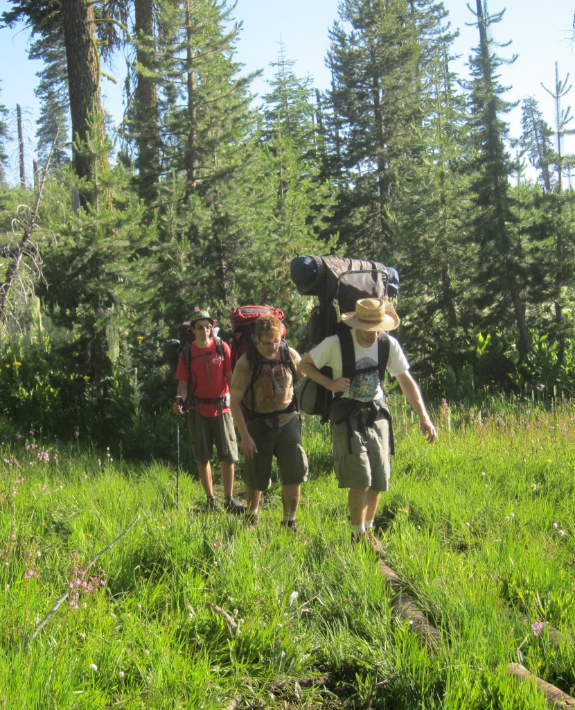
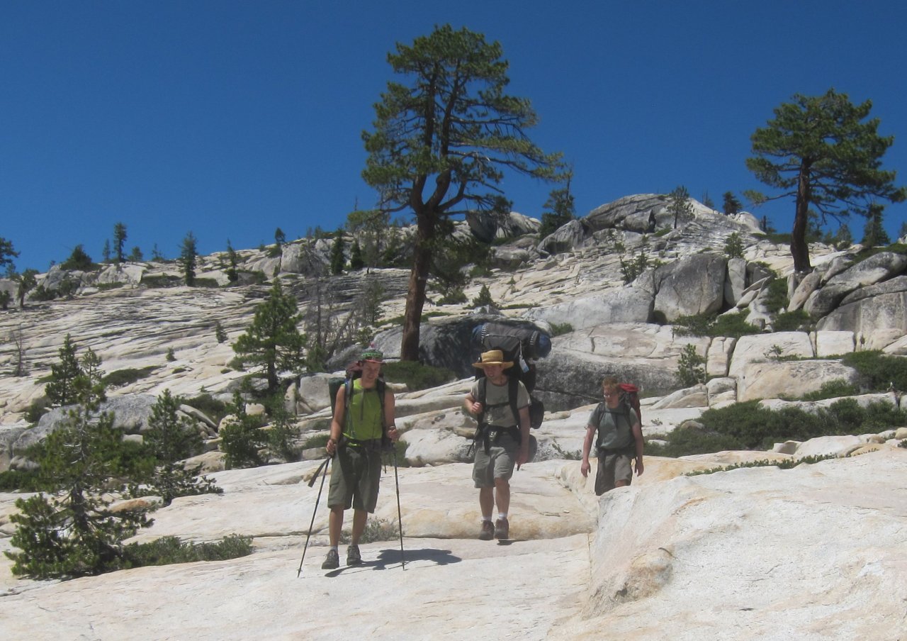
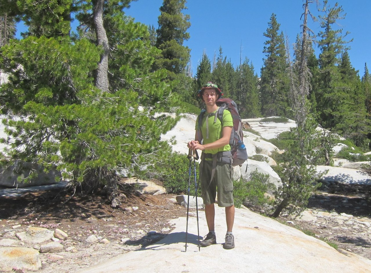
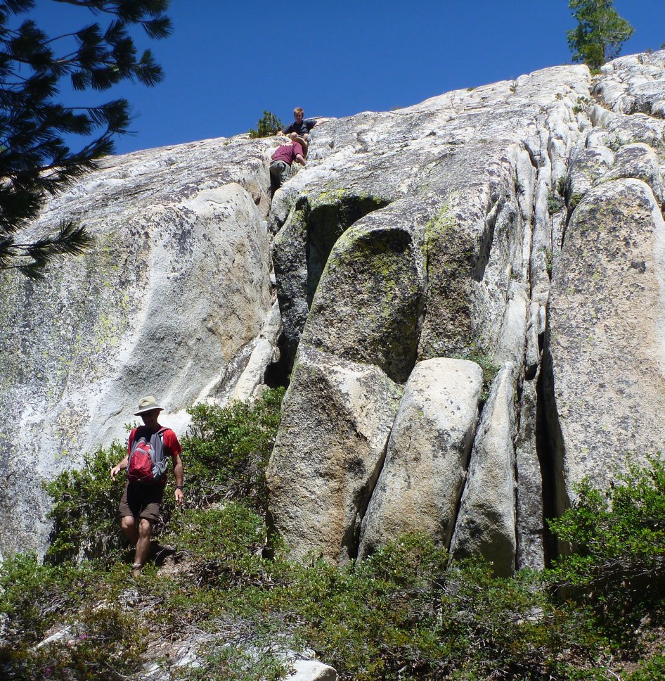
On the trail
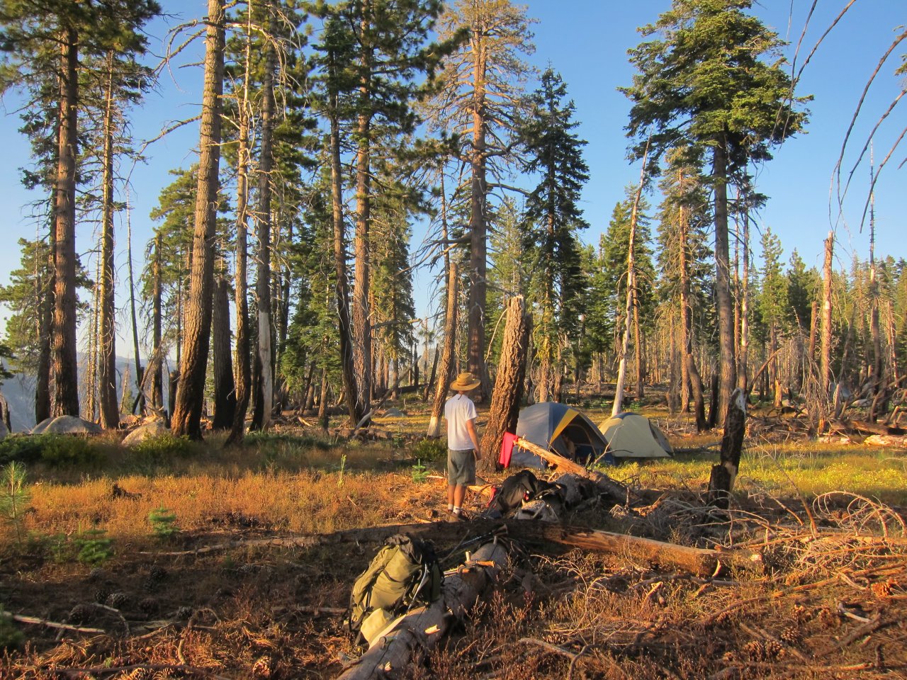
Campsite the first night
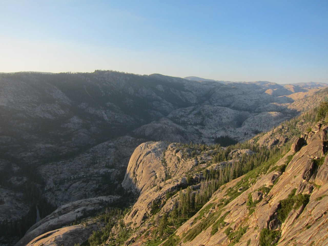
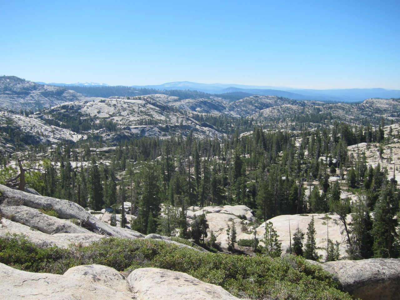
Sunset on the canyon rim
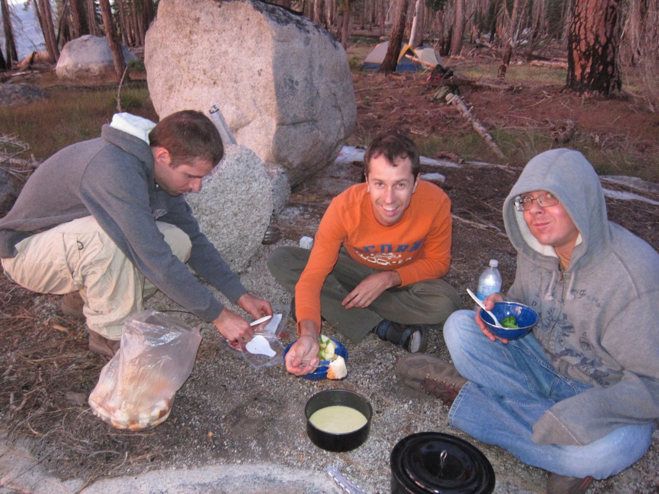
Fondue for dinner
The 2010/11 winter was very heavy in terms of snowfall in the Sierras. In July, the snowpack was still rated 200% above normal. So, I was looking for a scenic, uncrowded hike in an area at a relatively low elevation. Also, since Kip and Glenn were driving up from LA, it couldn't be too far north. What I found was an area on the northern border of Yosemite. The trailhead is accessed from the Cherry Lake and Eleanor Lake area.
We had a misadventure before we even got to the trail. The regulations require a free wilderness/campfire permit, which I applied for ahead of time. On the phone, the National Forest office in Sonora told me to head to Tuolumne City and then take Buchanan Road all the way to Cherry Lake, and that it would take an hour and a half from their office. Apparently the forest service doesn't realize that Buchanan Road turns off of the main road at one point, and turns into a gradually more and more treacherous dirt road. We wouldn't have known this if the GPS wasn't on, as it found the turnoff. Fortunately, all the dirt roads were on the GPS, so we could follow them toward Cherry Lake. Eventually we ran across a lady in a truck with her dogs who told us that there's no way we'd make it on the dirt road. We needed to go back out to the turnoff and continue on the main road, which is paved all the way to the lake. For some reason, the GPS was missing sections of this road, so in addition to being a stickler for the name, it didn't even have the correct route on it. Looking at Google Maps now, I can see how we might have been able to exit the dirt road later, but we didn't have that great of a map, or even know what the paved road was called (Cottonwood Road). We did extricate ourselves, and made it to the trailhead with no further problems, but we were 2 hours late.
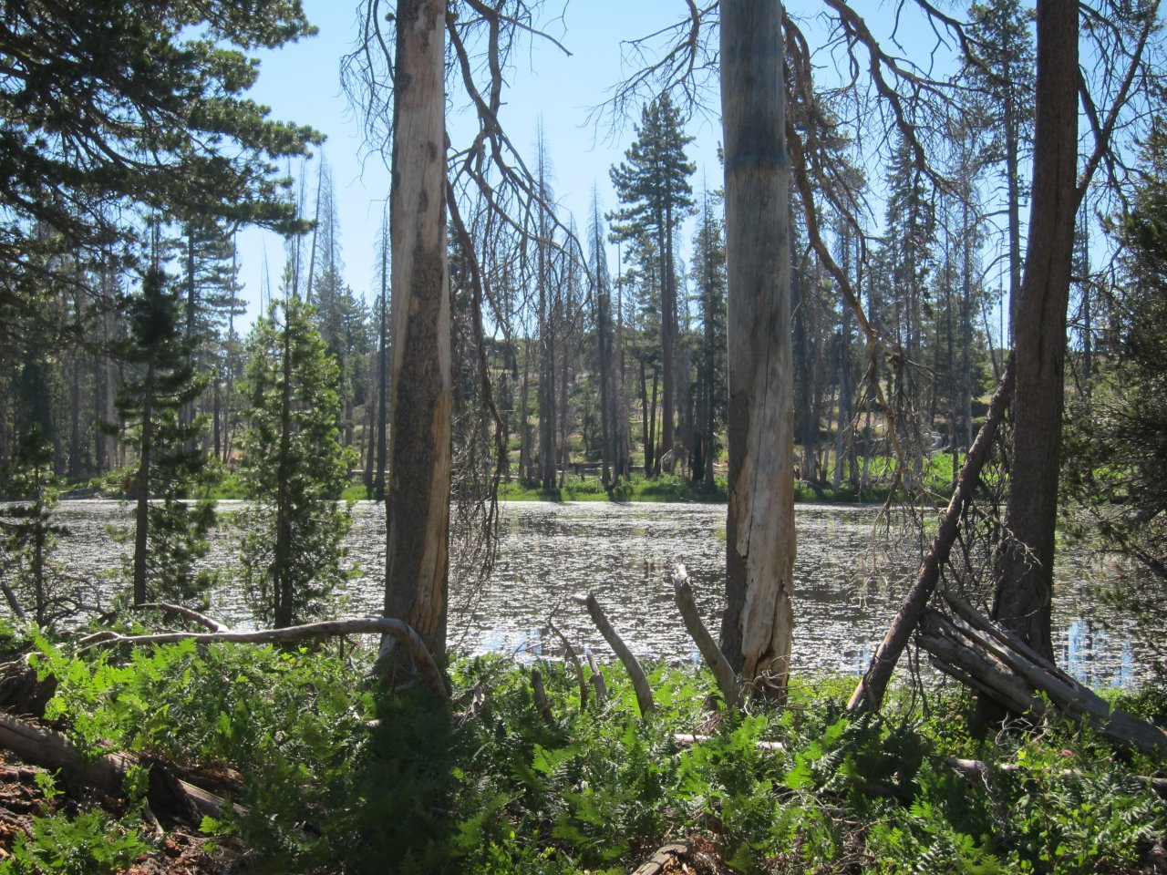
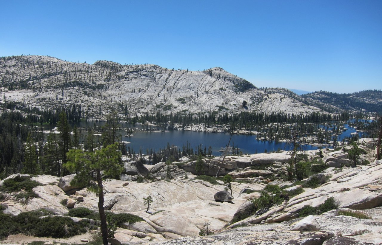
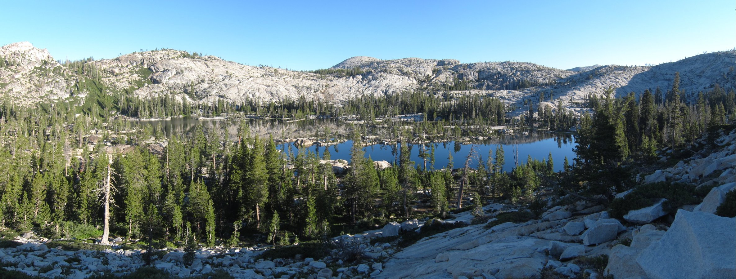
Arriving at 4pm wasn't too bad, as we just had a short hike scheduled that day so that the hike on Sunday wouldn't be a long, all-day affair. Also, the steepest climb was at the beginning, so we'd be able to recover from that. We ended up going 4 miles in 2 1/2 hours and made it to our planned campsite that night. This campsite was on Kibbie Ridge, just before Lookout Point. A short distance away from the campsite was a set of boulders that gave an amazing view up and down the Cherry Creek Canyon. Strangely, when we later visited Lookout Point, we found that the boulders behind camp gave a much better view. The area around us was pine forest with little undergrowth. Most of the trees had been burned at least partially, and shortly across the trail was a large area that had recently been completely burned out. After checking the internet when we got back, it looks like the fire was in 2004 or 2005. I would have guessed it was more recent than that.
For dinner that night we had cheese fondue with bread, broccoli, cauliflower, and prosciutto for dipping. Delicious! For dessert, we had chocolate mint brownies that Danny had made at home. We were so full of cheese that we couldn't finish them, but they made excellent snacks the next morning. As we hope for in our D&D games, the night passed uneventfully.
|
On the trail |
Campsite the first night |
Sunset on the canyon rim |
Fondue for dinner |
Here, I will pause to mention Glenn's backpack, an external frame which reminded me of the ones I used in Boy Scouts. I'd forgotten how high you load those things - he reminded me of a dwarf or hobbit, with gear stacked well over his head and canted crazily off to one side. I really miss all the pockets those backpacks have. I do not miss the frame getting caught on branches all the time.
 The big swamp |
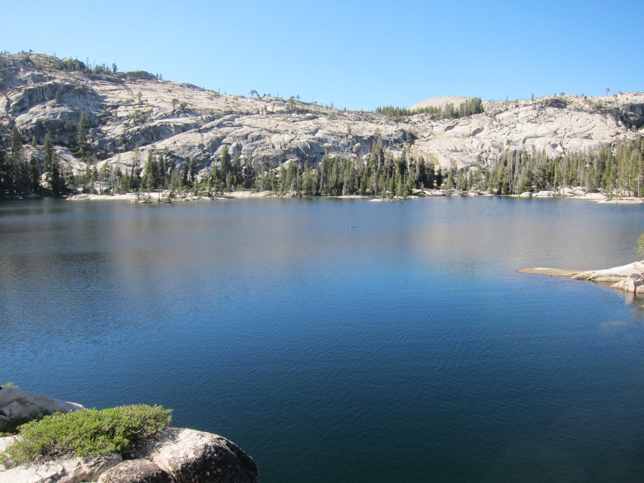
 First view of Many Island Lake |
 Hiking down the granite slope |
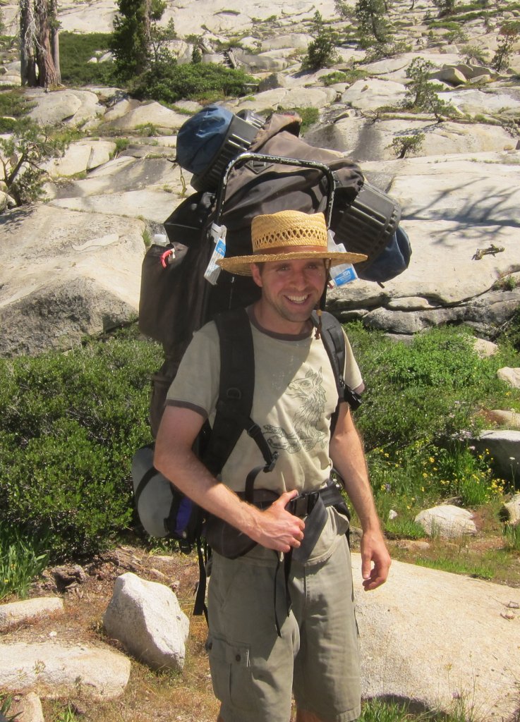 Glenn and his pack |
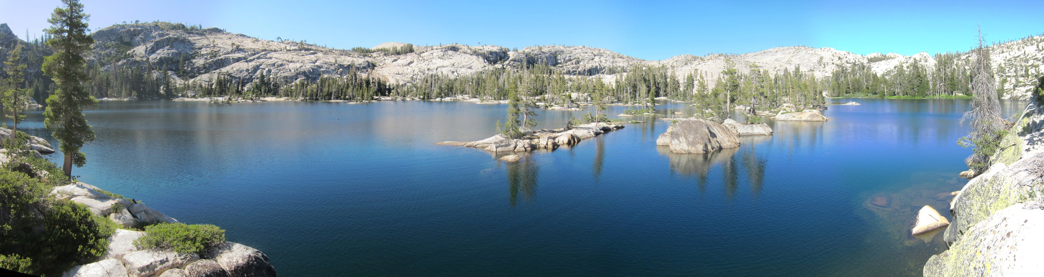
About 1pm, we broke out of the ferns and brush and into a nice flat area, bordered by a steep hill on one side and the lake on the other. After a short break for lunch, we searched uphill for a site that would give us a good view of the lake, but couldn't find anything flat enough. In the flat area, we did find a large bare stone with a sandy flat spot in the center. We hope that the stony area was large enough to keep the mosquitoes at bay, and decided to set up camp there (but not right away).
 Danny and his traveling hat |
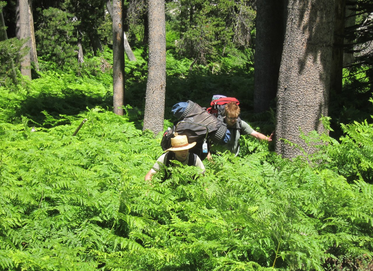 Man eating ferns |
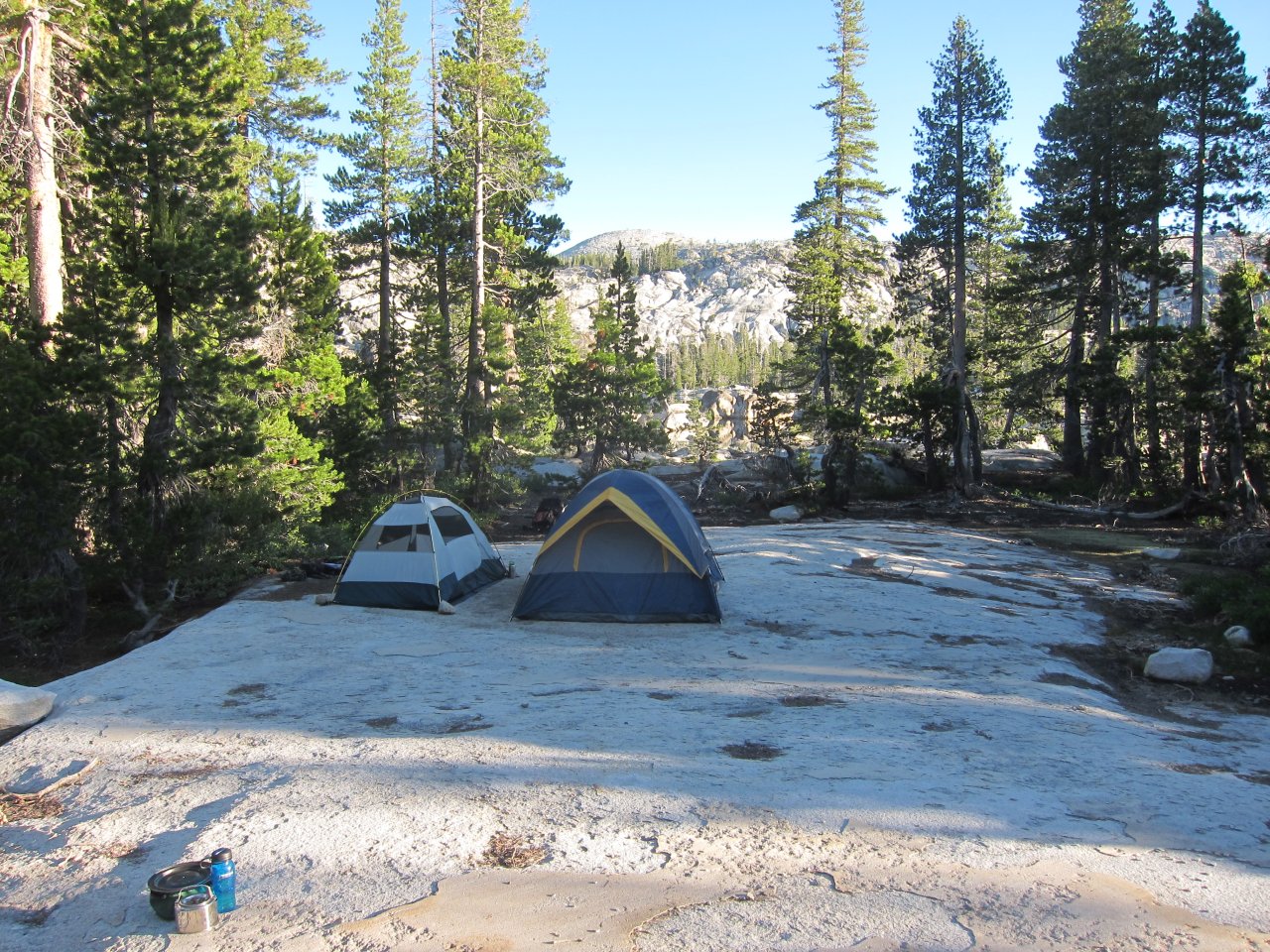 Our second campsite |
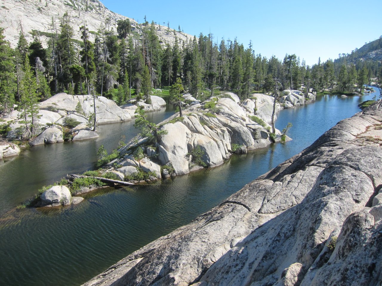
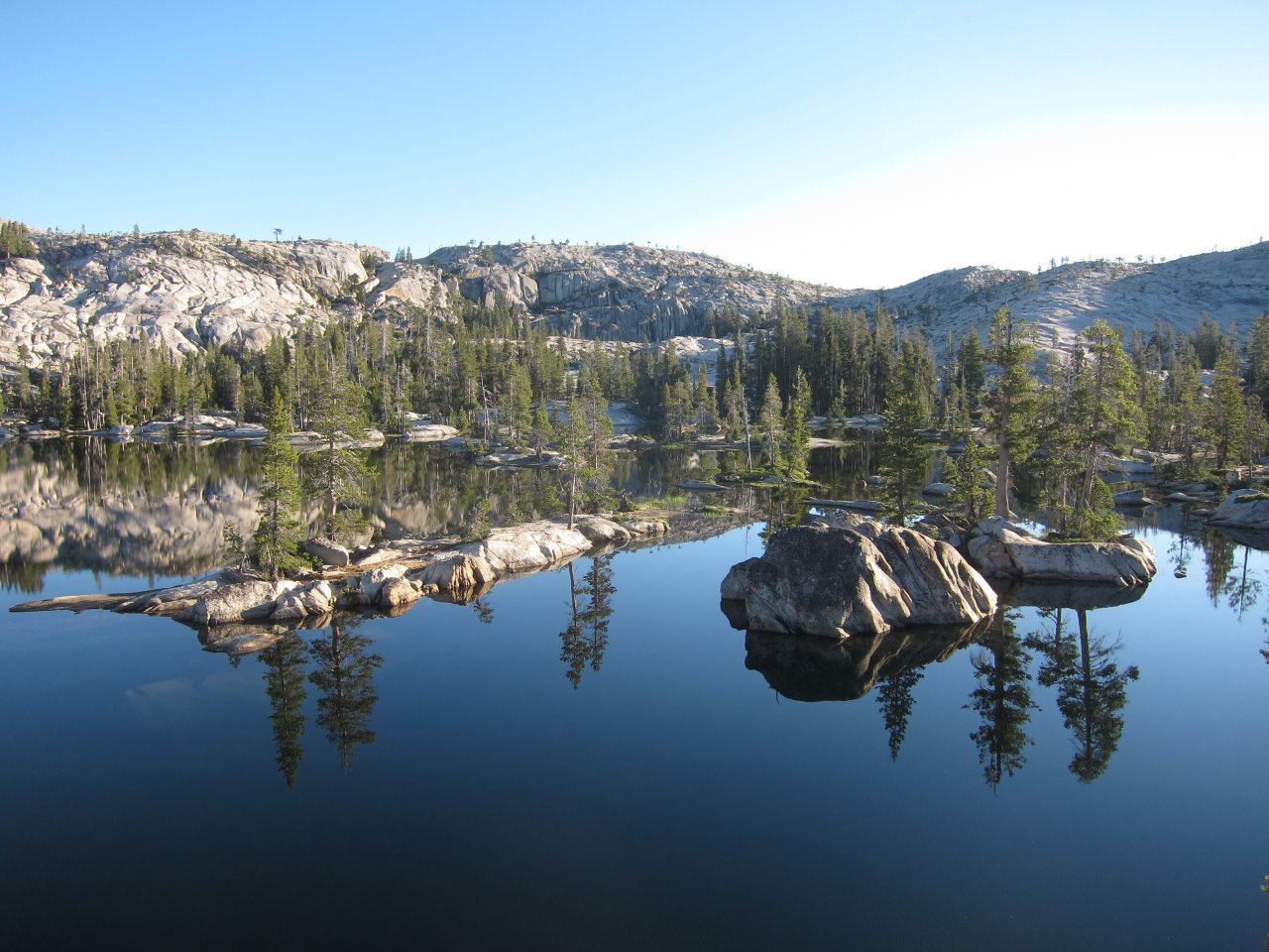
 Some islands in Many Island Lake |
 Try and spot Danny swimming in the lake |
 A fun island |
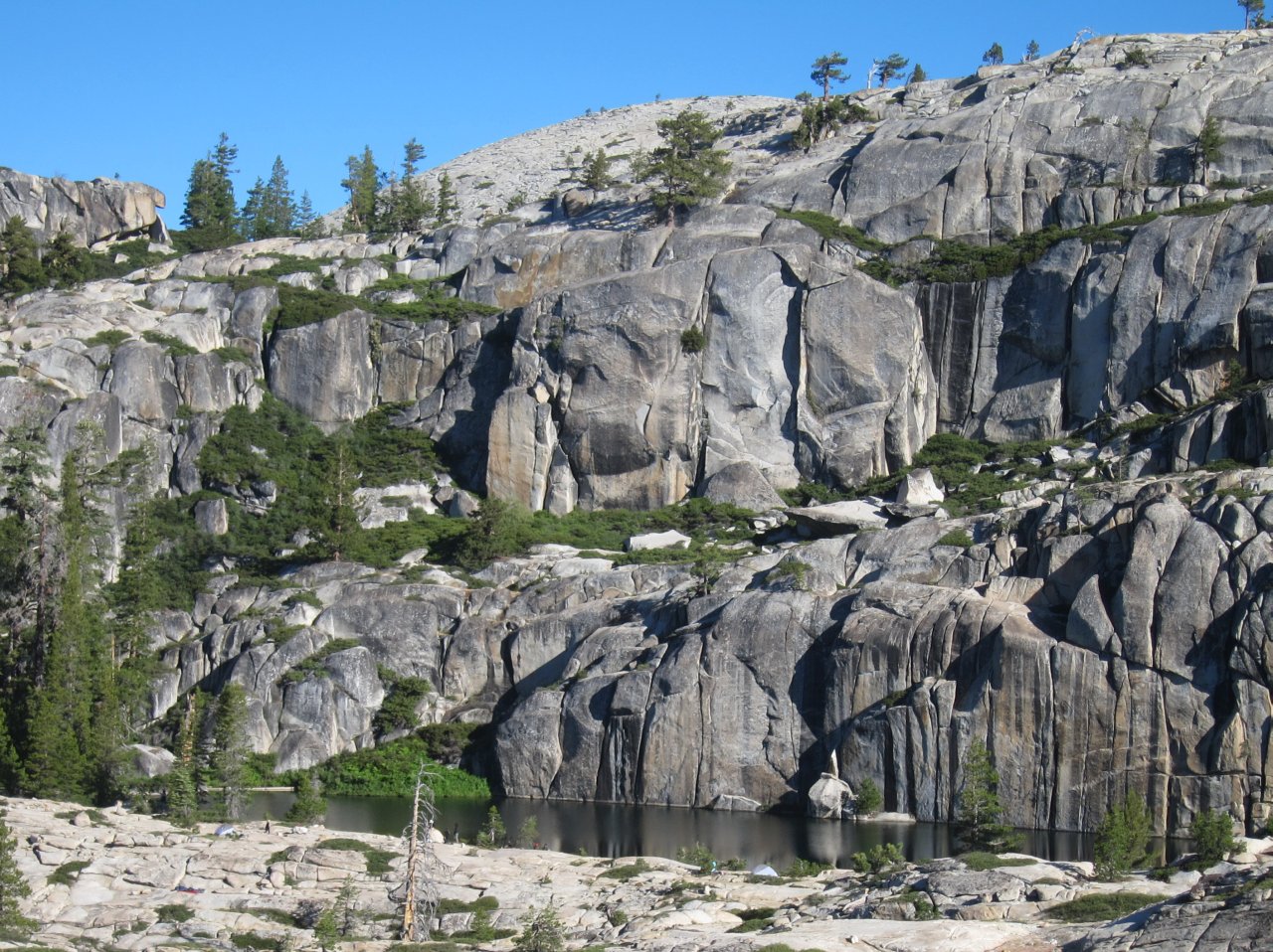
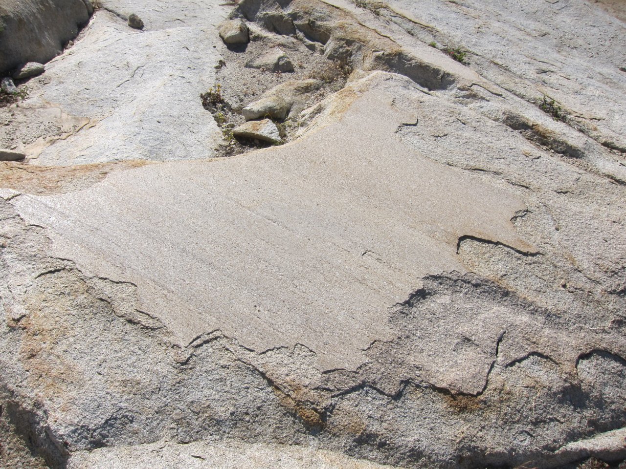 Granite polished by glaciers thousand of years ago |
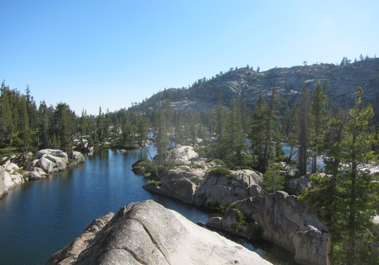 More Many Island Lake |
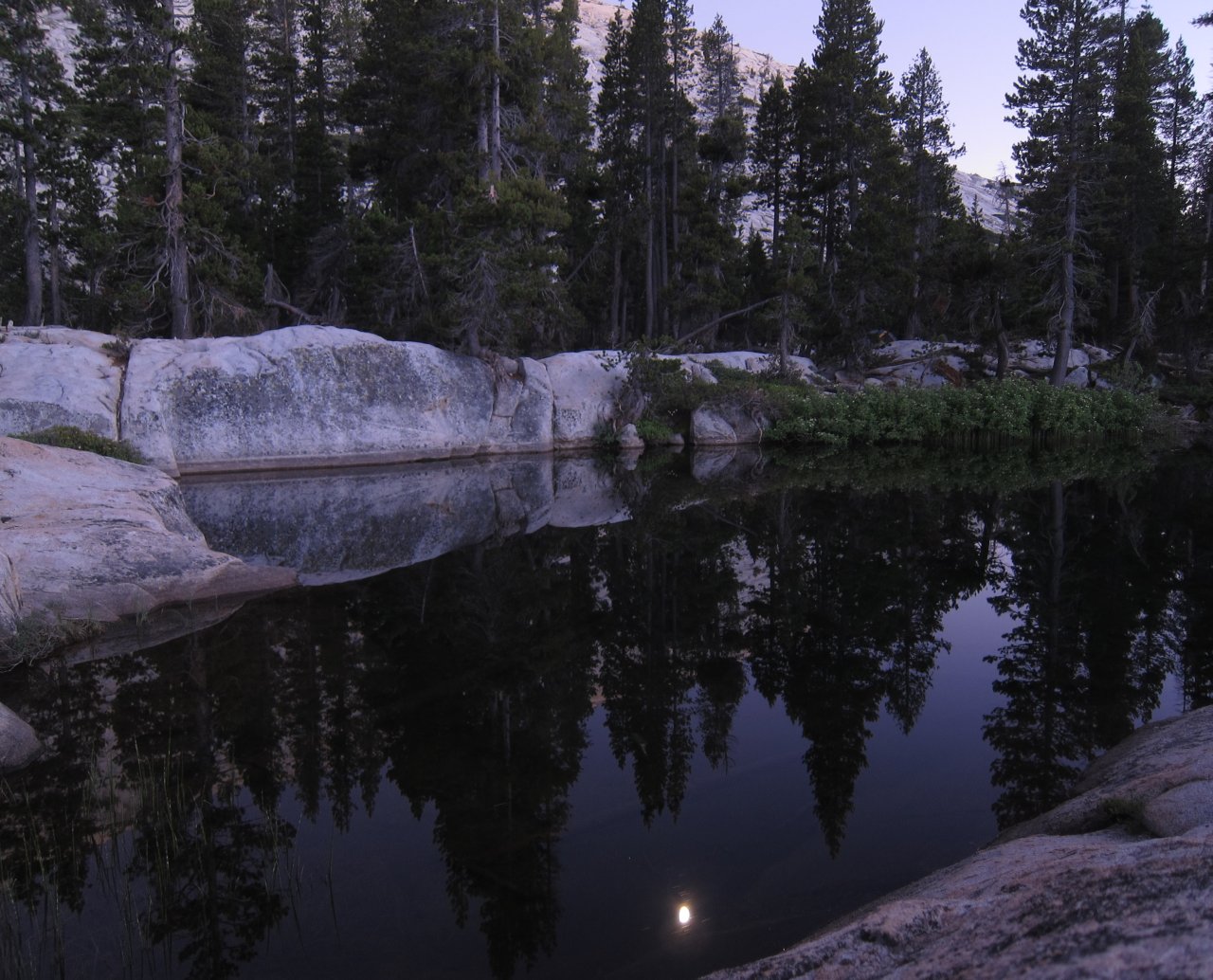
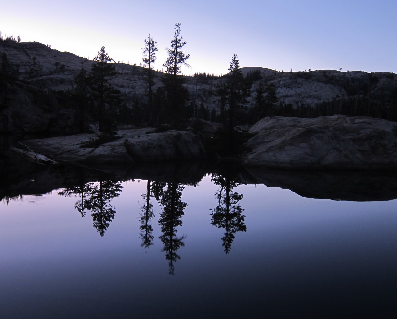 Twilight reflections |
 Reflected Moon |
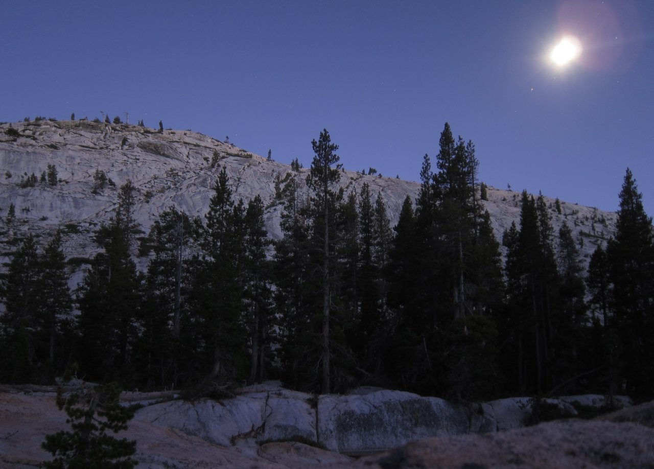 Not the sun |
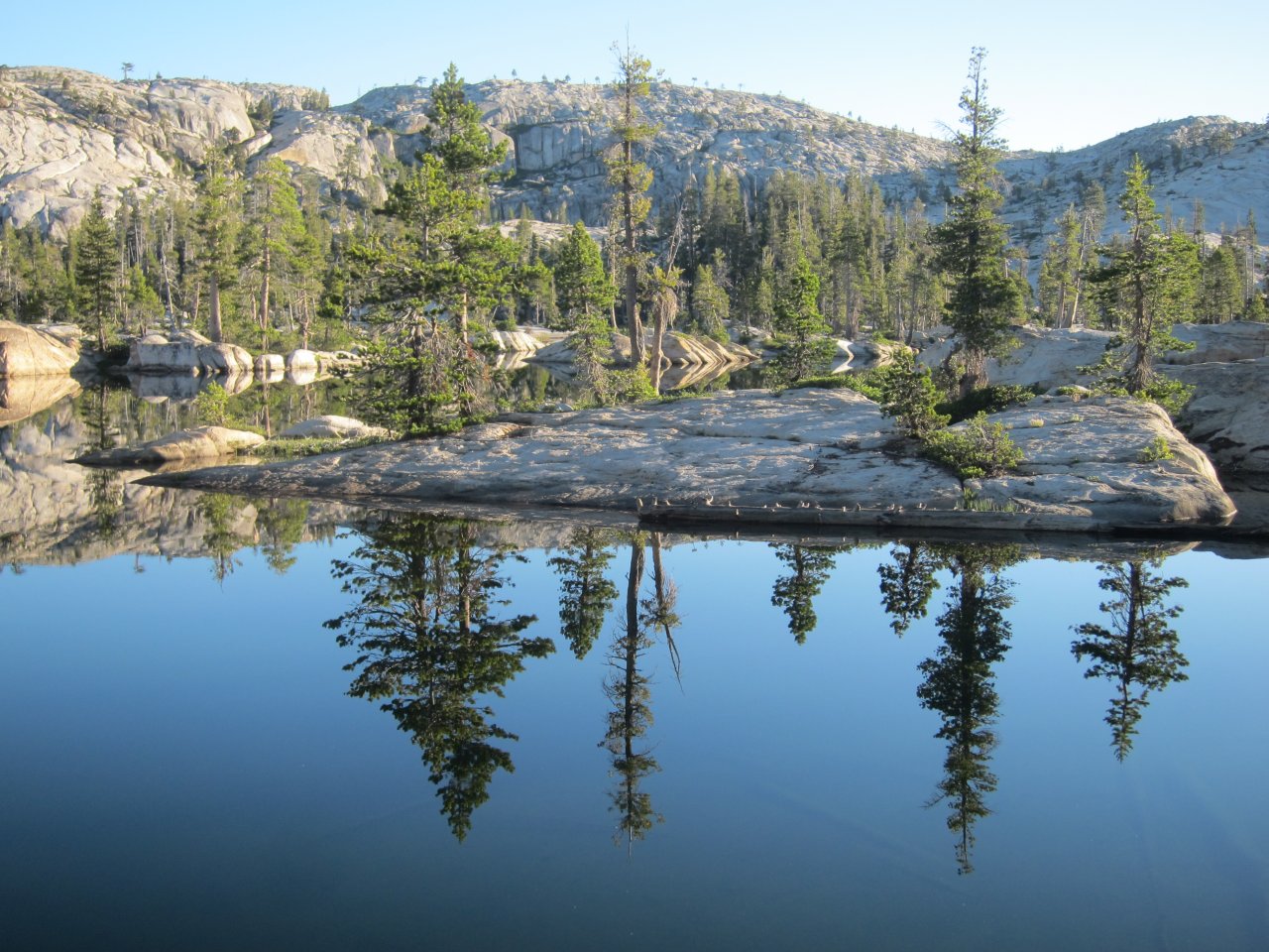 Sunrise mirror |
 A very still lake |
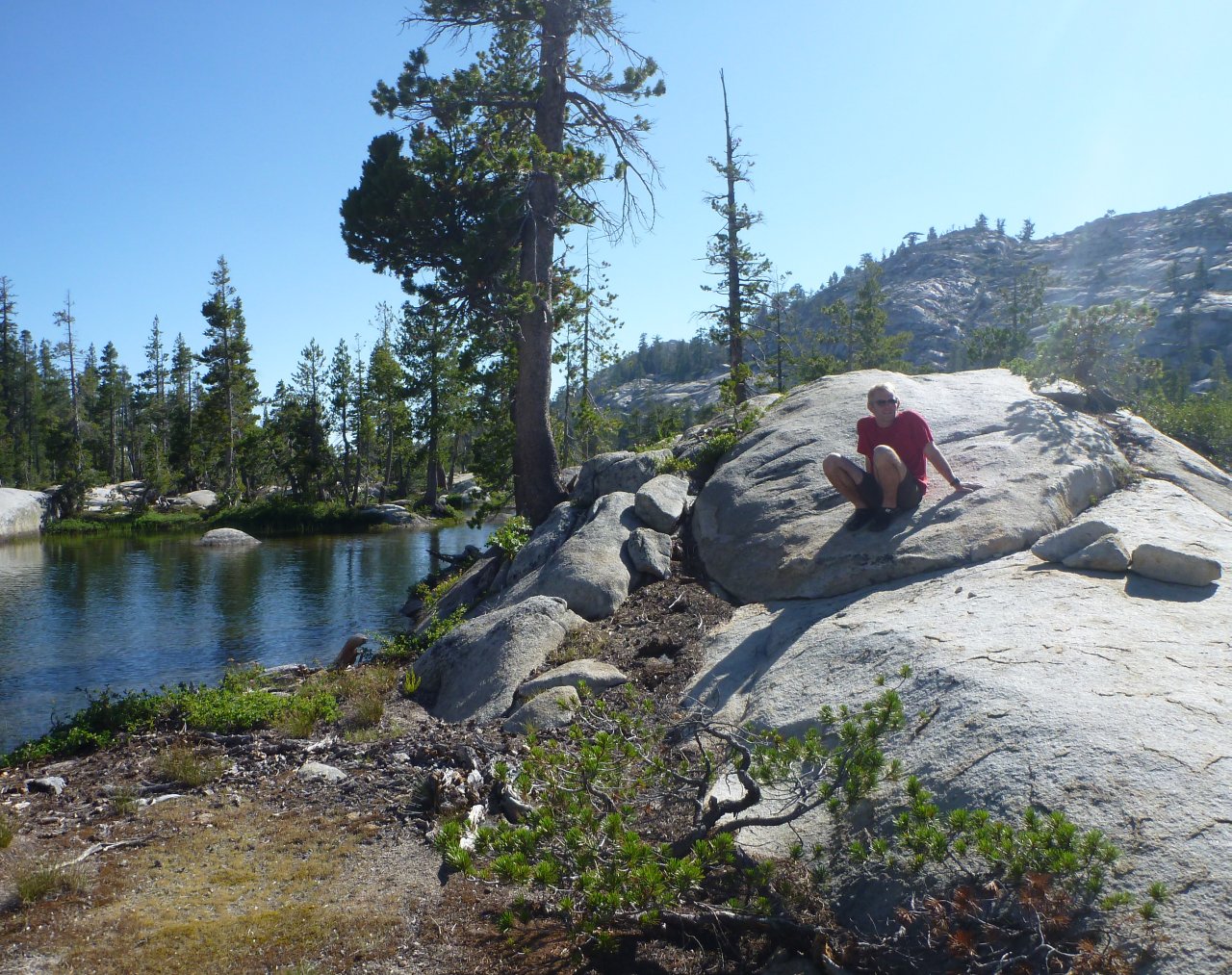 Ryan on a rock |
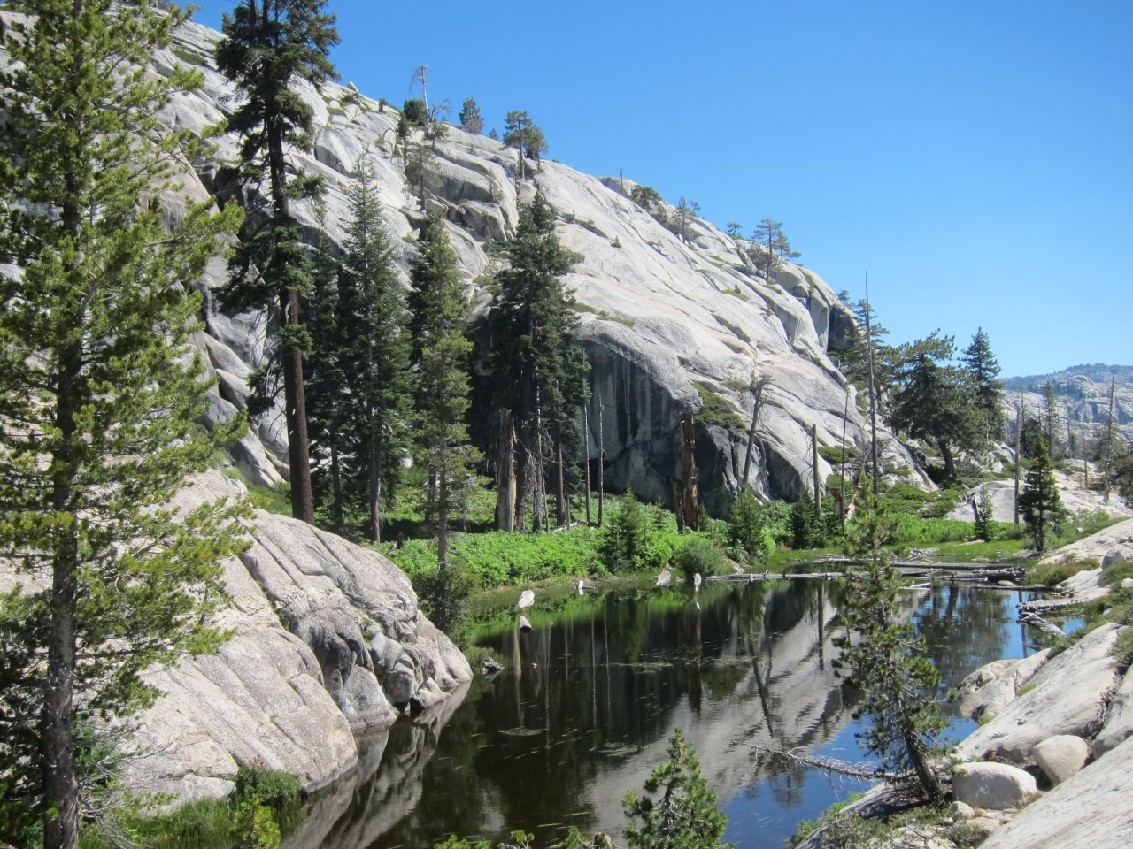
This was a cross country trip, so there was no trail. We had to pick our way up and down the slopes, and find ways through or around the areas of heavy vegetation. We climbed glacier polished granite, walked on logs through swampy areas, and waded through chest high ferns. On the way, we saw an inviting lake not too far off and thought we might stop by on the way back. After a lot of ups and downs and some obstacle avoidance, we finally made it to the point where we could see Spotted Fawn Lake. The only problem was that it was quite a ways down. Although the lake was pretty, we decided it wasn't really worth the effort to go all the way down and then back up. We'd rather visit the lake we saw on the way, and then spend the time at our own lake, which was at least as nice, and probably nicer. So, we took a couple pictures on the overlook and turned around. On the way back, we stopped at the smaller lake we'd seen for lunch and a swim. This lake had almost a maze of natural canals running off of it, and was quite refreshing after hiking in the high altitude sun.
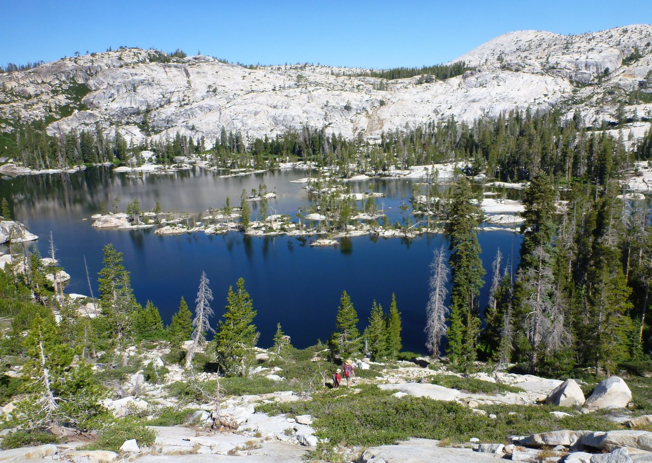 Many Island Lake from above |
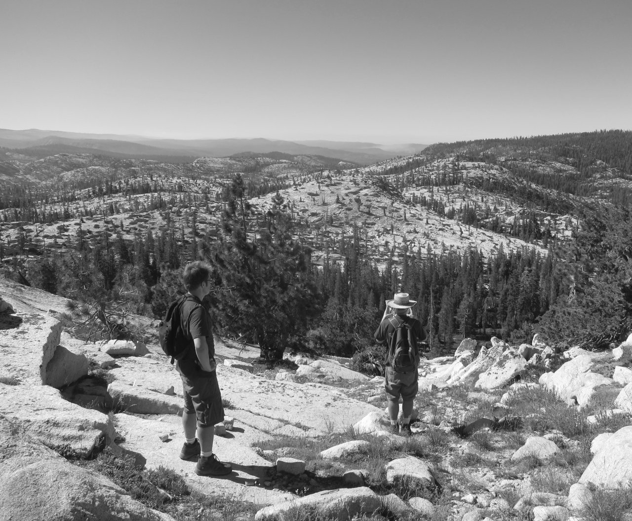 Glenn checks the map |
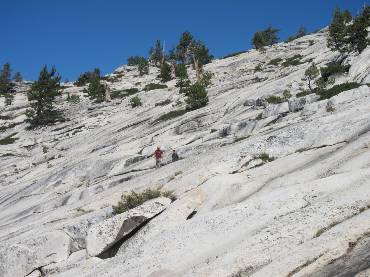 Hiking on the granite slopes |
 Long distance view |
 A small lake |
 Above Spotted Fawn Lake |
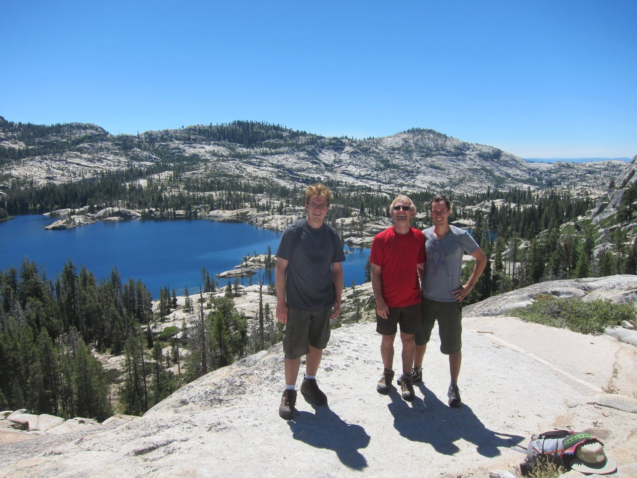
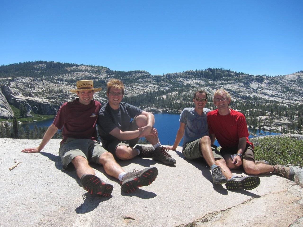 All 4 of us at Spotted Fawn Lake |
 Tricky downclimb |
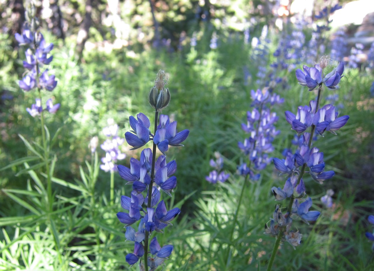 Pretty flowers |
After another beautiful (but cold) night, we got up early-ish to have a quick breakfast of oatmeal with fruits and nuts while packing up. We had 3 options for hiking out. We could follow along the edge of Many Island Lake and then bushwhack to Kibbie Lake, where we could pick up a trail back to Cherry Lake and the cars. This would be the shortest, but the most difficult. We could head up toward the trail we came in on, but take a less steep route. This would be the easiest, but the longest, adding an extra couple miles distance, plus a climb up and over the pass. And, of course, We could go back the way we came. We decided that with the slow travel yesterday, even without our packs, the bushwhacking probably wouldn't be a great option, especially since Kip and Glenn had a long drive back home. We also didn't really like the idea of climbing back up the steep area, so we took the longer but easier route.
On the way up to the trail, I did get a better look at a small lake, built into a ledge on the side of the steep area. There was a group camped there, and it looked like a fun spot. Also, after we crested the ridge and were just getting onto the trail, we got a good look at the granite slickrock area of Cherry Creek. That also looked like a fun area to explore at a later date. The hike up and over the pass was steep, though. At least it was on the way out when our packs were light. We stopped at the real Lookout Point for a brief lunch, and then continued on to the cars. On the way out, we met a ranger who actually checked our permit and verified that we had bear canisters. It seemed odd to see a ranger on such a low traffic trail. I think we got back to the cars around 2:30 or so, but I'm not sure. It was a beautiful area, and I'd definitely like to get back there again to see more of it.
 Interesting lake on the cliffside |
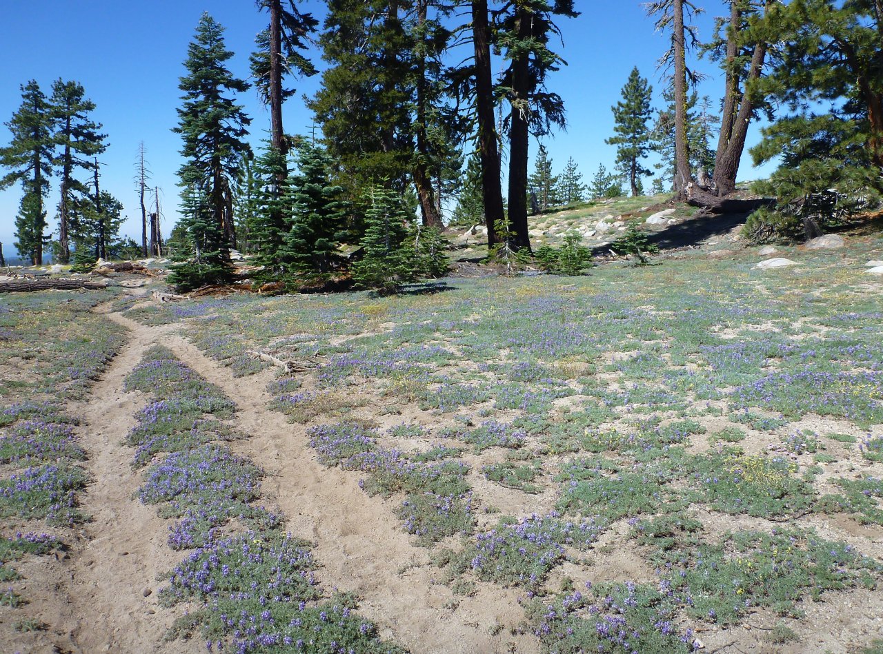 Trail through wildflowers |
 Panorama of Many Island Lake (big) |
 Panorama of Danny swimming in the lake (big) |
Other trips