On Saturday I was really itching to get outside and do something, so I decided to go to Yosemite or Big Basin. No one else was interested in going on an all day trip, and Danny was in LA, so I chose Yosemite and went by myself.
I was up late the night before, so I pushed back my departure time from 6 to 7am. Traffic was still light, so there were no driving problems until Yosemite. I was planning on doing North Dome, to complete the trio, having done Cloud's Rest and Half Dome on previous trips. However, when I got to the area, it was covered in smoke. The NPS was doing a huge controlled burn near the beginning of Tioga Road to cut down on the likelihood of a fire next summer. At first I though North Dome might still be OK, because it was still many miles down Tioga Road. But when I got there, it was still smoky. I decided to drive to Olmstead Point to see what the area looked like from there - I couldn't see a thing. Visibility was 1000 to 2000 feet. I had to find a new hike simple enough I wouldn't need a topo map. I had a backup plan of Ragged Peak and Young Lakes, but it was almost 12:30 now, and I estimated there was probably not enough daylight for that.
Looking at the park map, I saw that Unicorn Peak and Mount Hoffman both looked interesting. They each have a lake right next to them, so it would be quite scenic. I drove to the Tuolumne Ranger Station to get info on these peaks to see if they were climbable without equipment. However, the ranger station was closed up for the season. After a couple of tries, I found a working phone and called Danny. He looked up some trip reports on climber.org, and I determined that Unicorn Peak was probably steeper than I wanted.
I decided to climb Lembert Dome first, because I was right near it, and it was a very short (1.5 hours) hike. From there, I'd be able to see Unicorn Peak and Ragged Peak, and I might be able to tell if either was doable in what was left of the day. If not, there'd still be time for Mount Hoffman, as it was a short hike.
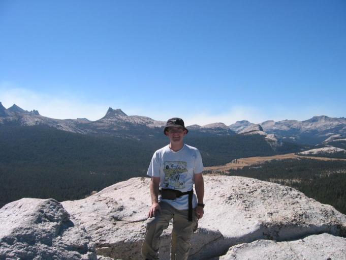
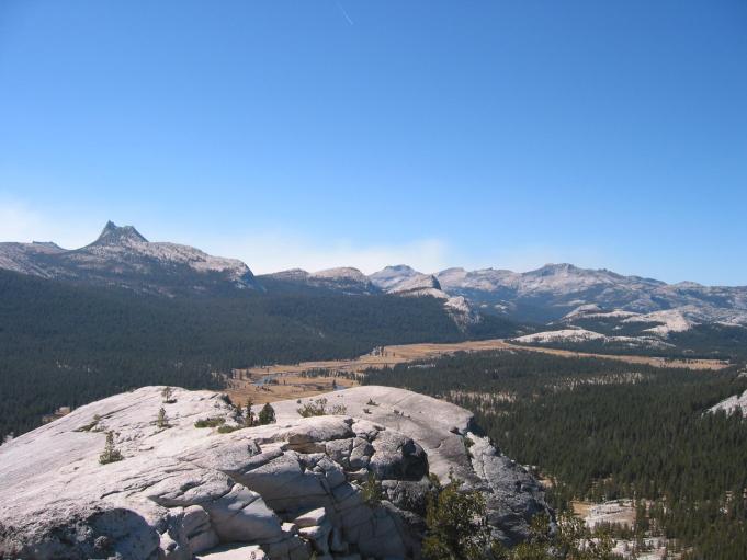
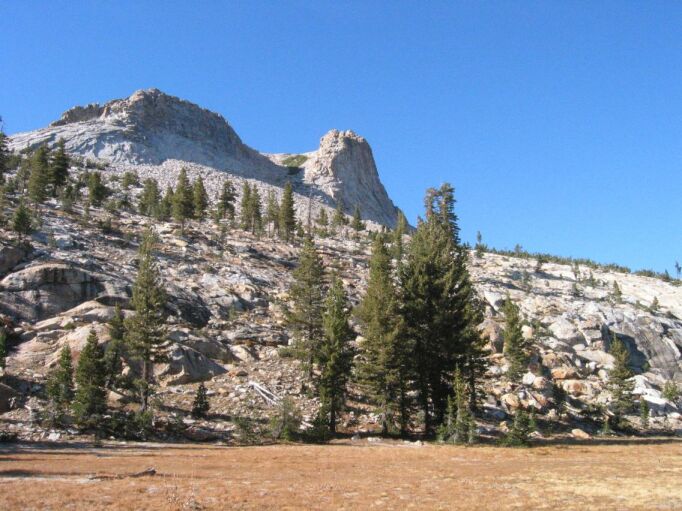
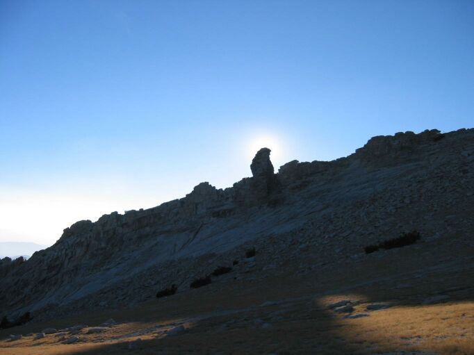
Lembert Dome is right next to the road, right near the meadow. It's a big hunk of granite sitting there in the middle of things. The path goes from the parking lot around the left (west) of the dome, around the back, and the up the northeast side. Not a terribly hard climb, and very short. It took less than 45 minutes to get to the top. I passed two individuals coming down, and one group going up. No one was on the top when I got there, although another group arrived shortly after. It has a nice view of the meadow, with the river winding through it, and good views to all of the surrounding peaks, including Mount Dana, which I hope to visit on a future trip. For such little effort, it certainly has great rewards. The top of it is fun to play around on, as there are several sections at different levels.
Ragged Peak looked far away, I was sure I couldn't make it in the time I had left. Unicorn looked tough, and I didn't think I had time to try (although I would have if I hadn't done Lembert). So I decided to go for Hoffman. On the way down, I passed two other groups coming up. All told, it took 1:15 round trip. When I was leaving, there were two backpackers looking to go to the May Lake trailhead, which was my exact destination, so I picked them up. One was an asian girl who had just completed her first backpacking trip with her friend, a guy who used to be a park ranger further south, and was quite experienced with the Sierras.
Total distance: 2.5 miles
Total elevation gain: 866 feet
Maximum elevation: 9450 feet
Time: 75 minutes
There's a lot of trailheads at the May Lake parking area, and it was very crowded, so it took a minute to find the right one. I wanted to experiment hiking with music, so I brought my MP3 CD player and put in a disk of 80's tunes. It turned out to be very pleasant, able to distract me from thinking about the climbing, but not being so distracting to detract much from the scenery. When I got toward the top, I took it off. I started on the trail about 2:30. Through the trees, you could see Mount Hoffman.
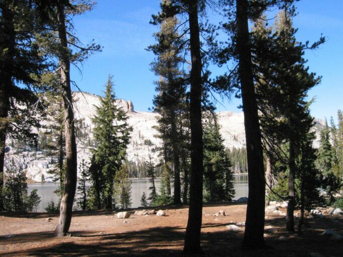
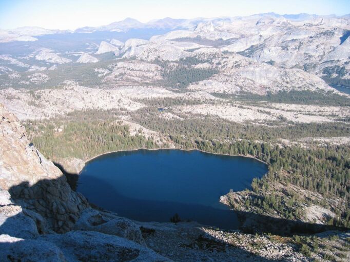
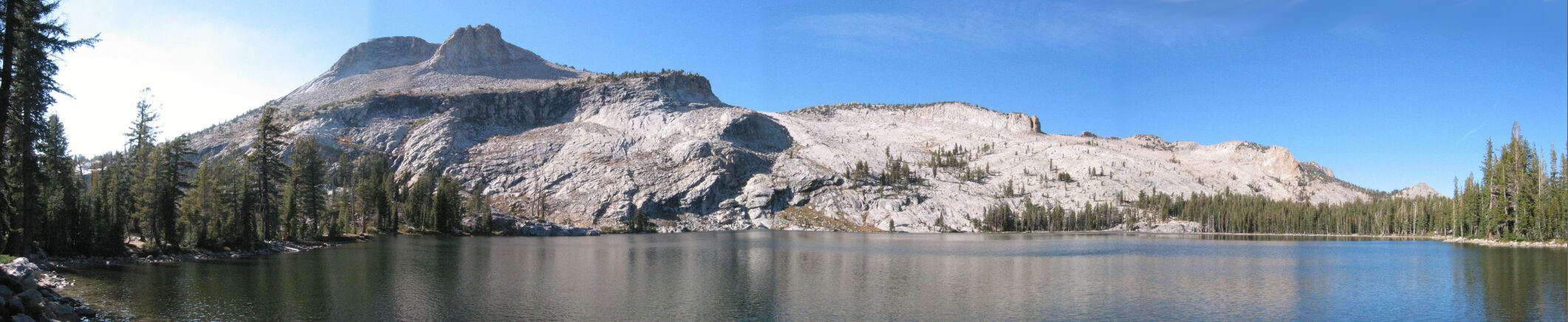
The trail goes for about a mile and a quarter through pine forests and granite boulders at steady but shallow grade. Then it opens up into a large camping area on the shore of a beautiful lake. There's a High Sierra Camp there somewhere, but I didn't bother looking, as it was closed for the season. During the summer, it would have been a good place to try and get dinner on the way out. As I arrived, a large group was arriving from a different direction to set up camp for the night.
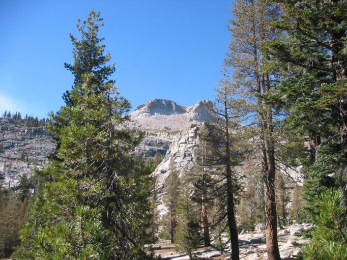
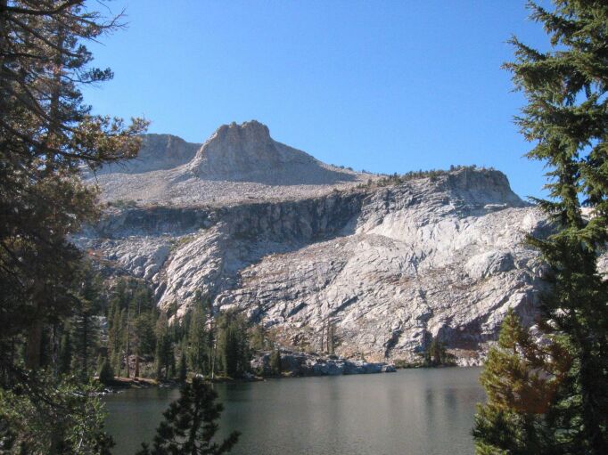
Mount Hoffman towers over the lake on the far side. It looked awfully high, certainly more than the thousand feet I was expecting. Still, I knew what four thousand feet looked like from the base of Whitney, and I could tell it was nowhere near that, or even half of that. (According to the topo software, it is 1556 feet above the lake). It looked like you could approach it from either direction around the lake, but the side to the left was definitely shorter, and had an obvious path heading in that direction, so I went that way. It was about 3pm now.
In a short while, the narrow path crossed a dry outlet stream for the lake, and then started to head up a small gully. The gully had significantly different vegetation from the surrounding area, and looked like part of it might be a stream, maybe when the snow is melting from the upper elevations. Looking back, you can see the lake. After reaching the top of the gully, the path crosses a small, but very pretty meadow. Mount Hoffman rises above one edge of the meadow, and the other edges are pine trees. I'm not sure what caused a meadow there, but it was very scenic, and the pictures don't come close to doing it justice.
After crossing the meadow, the trail goes through a short sparse pine forest, and then begins to climb up the side of the mountain. The slope was medium sized granite rocks with lots of sandy dirt in between. Small cairns showed the way to go, although it was pretty obvious. It turns out they're more useful on the way down, to prevent you from going to far to the left or right and either missing the meadow or coming out on the steeper slope above it. The ground slowly changes character as it approaches the top, becoming more gravelly, and the vegetation becomes more meadow like. The beginning of this part, where it was the steepest, was the hardest. Appropriately, at this point, the music was "Take My Breath Away". I had to laugh.
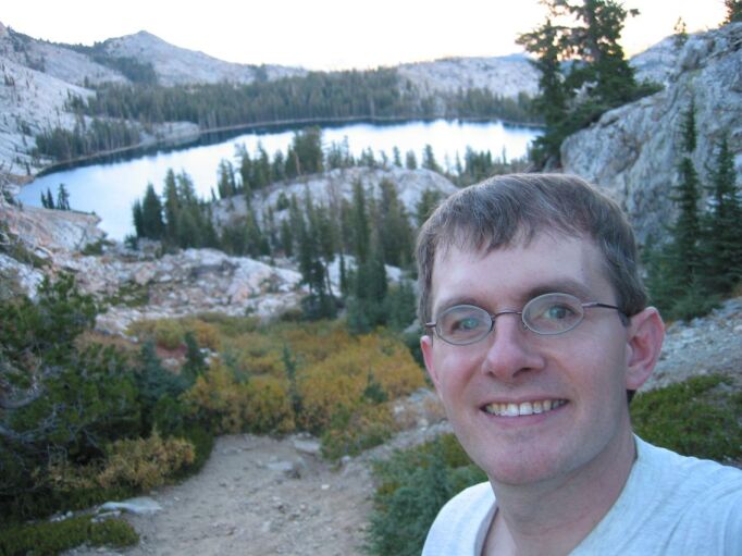
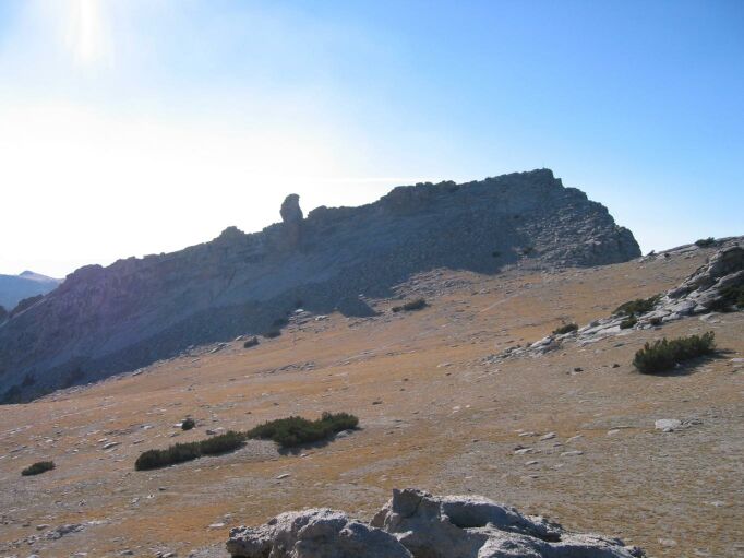
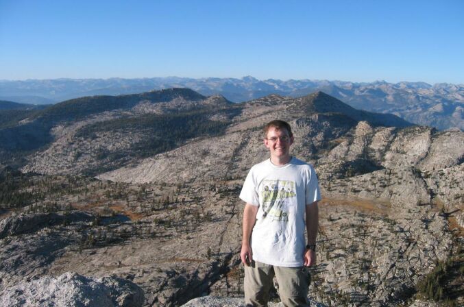
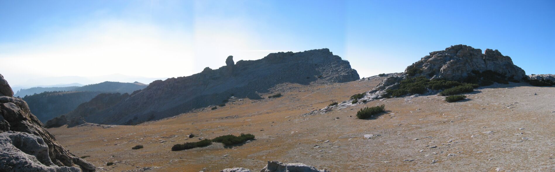
The top is a fairly flat meadow with four large granite summits sticking out of it, and a slope that heads down to the area I was coming up from. The other sides are formed by three of the summits and a steep cliff. It was even more beautiful than the meadow below, and as mountaintops go, I think the prettiest I have ever seen. It was like a small grassy field perched on top of the world, with mountains all around off in the distance.
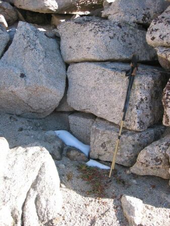
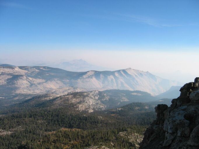
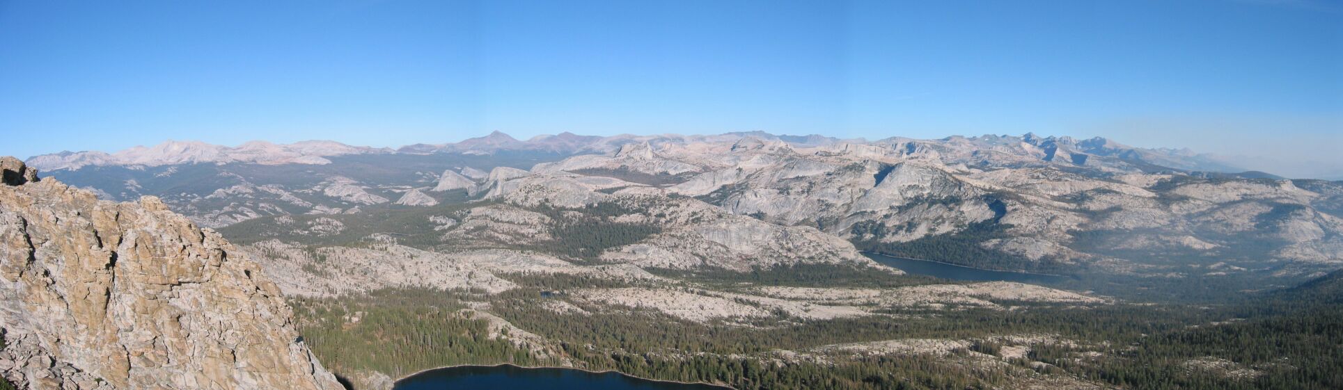
First, I explored the two summits that I had seen from the lake below. They offered a spectacular view of the lake and the mountains off in the distance in one direction. The summit ridge on the far side of the meadow was clearly the tallest, and had a small antenna to prove it. I looked around, and saw a USGS marker, but no register here. I did see a few small patches of snow that survived from the previous winter, and would probably make it to the next one, which is due to begin soon.
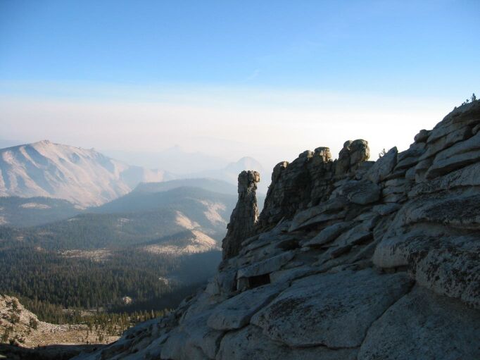
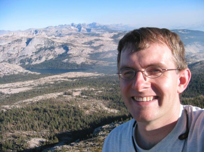
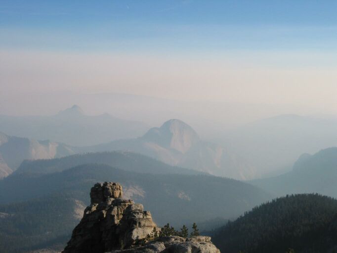
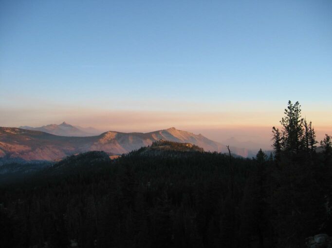
As I was heading down, two people appeared on the trail from below, but they didn't notice me until I was all the way down to the meadow. I walked over and met them at the base of the true summit peak. They were visiting from the east coast, and were envious of closeness to the park. We climbed to the summit together, and I soon spotted the register log, such as it was. It turned out to be a bunch of scraps of loose paper written on all sides stuck in a torn ziploc bag which was inside of a metal box labelled SRC that was missing its hinge. I found a blank spot and made a log entry. I admired the scenery with its 360 degree views, and took a lot of pictures. From here, I could see the smoke from the fires, which almost obscured Half Dome. On the far side of this summit, way down, was another smaller lake, with a couple of tiny ones in the distance. The trail beckoned on, over the edge of the summit, maybe down to this lake. But it was 5:30pm, so I had to start heading down. The couple stayed to eat some food.
The trip down was uneventful. At the meadow, I stopped to put my jacket on, as it was getting dim and cold in the shadow of the mountain. Sunset started just before I reached the lake. The group camping at the lake had started a fire and was bundled up in heavy coats and hats against the cold. I wasn't that cold because I was working pretty hard and going fast to beat the darkness. The smoke did make for a very pretty sunset (another picture). I had my LED headlamp in case I didn't make it, but it's always much easier to find the trail with the sunlight, and the headlamp isn't so great for the hour around twilight (but its compact size, weight, and extended duration more than make up for that). I made it back to the car just before it was reaching this stage, and the time was 7pm. There were only two other cars left in what had been a fully packed lot.
Since this was my first solo trip, I was interested in my pace. I hurried on the way down, and could easily have stayed a bit longer at the summit, but my time is very close to the standard formula: Distance (in miles)/2 + positive vertical elevation change (in feet)/1000 = X hours
Finding food on the way back was a bit of a problem. The nearby places tend to close pretty early on Sunday in the off season, and it took a long time to get out of the park since I was so far in and the smoke on the road required slow going in some sections. The further I went, the larger the towns got, but the later it got. Eventually I had to give up on good food and get Taco Bell.
Here are some panoramic views, you'll probably have to scroll to see the whole picture:
May Lake
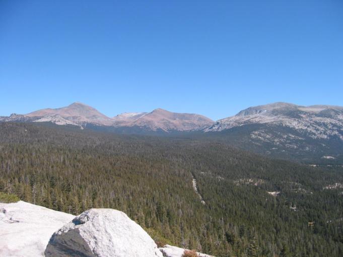
View from the top
Upper meadow
Total distance: 6.0 miles
Total elevation gain: 2005 feet
Maximum elevation: 10850 feet
Time: 4:30 hours
Other trips