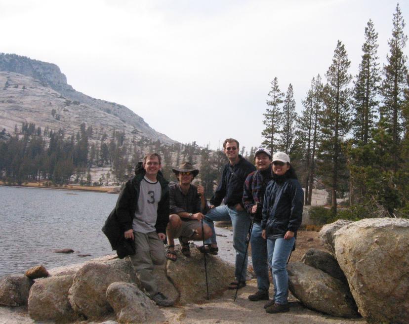
Along for this hike were Ryan, Mike, Shad, Shawn, and Mia. This trip got off to a better start than my previous one. Instead of leaving an hour late, we were only a half hour late, and we picked that time back up on the way there. Originally, I had planned for use to do the Ragged Peak hike. However, after some consideration, it looked like the Cathedral Lakes area might be a better choice, as it would give us more options - Cathedral Peak or Echo Ridge, the possibility of 3 alpine lakes - as well as a slightly shorter overall hike.
Shad, Shawn and Mia met at my house and we proceeded to Pleasanton to meet Mike. Since both Shad and Mike had a jerky affinity, they ended up in the same car, and we drove on to Yosemite. Fires were still burning there, but the smoke was a lot less than when I had visited two weeks ago. We arrived at the Cathedral Lakes trailhead at roughly 11:15. Shad had such a great experience hiking Half Dome in sandals, he decided to use them again this trip. Mike did the same, while the rest of us thought they were kinda crazy.
There was only a handful of cars at the trailhead, so there was no problem parking. It was a bit chilly, so some of us put on extra layers. We stored our food in the bear boxes, and set out at a brisk pace. Perhaps too brisk, because we missed the unsigned turnoff to the trail which heads to Budd Lake. I didn't pull out the map until it was too late - we'd already gone a fair ways uphill and didn't want to turn back. We decided that we could always do the route backwards, and continued on.
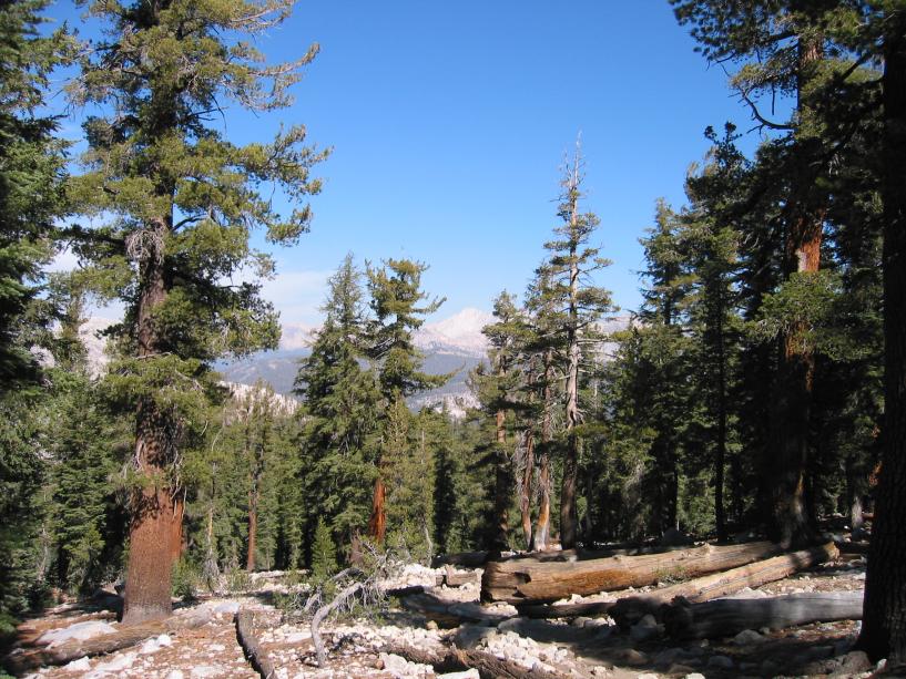
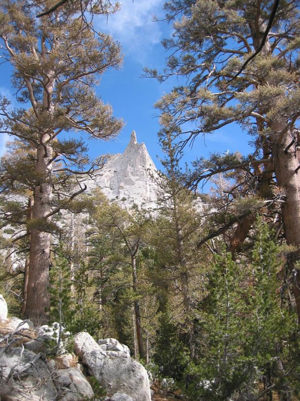
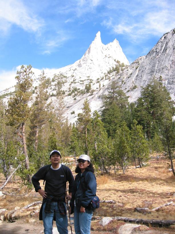
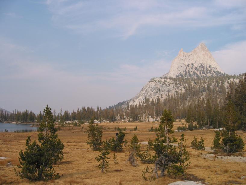
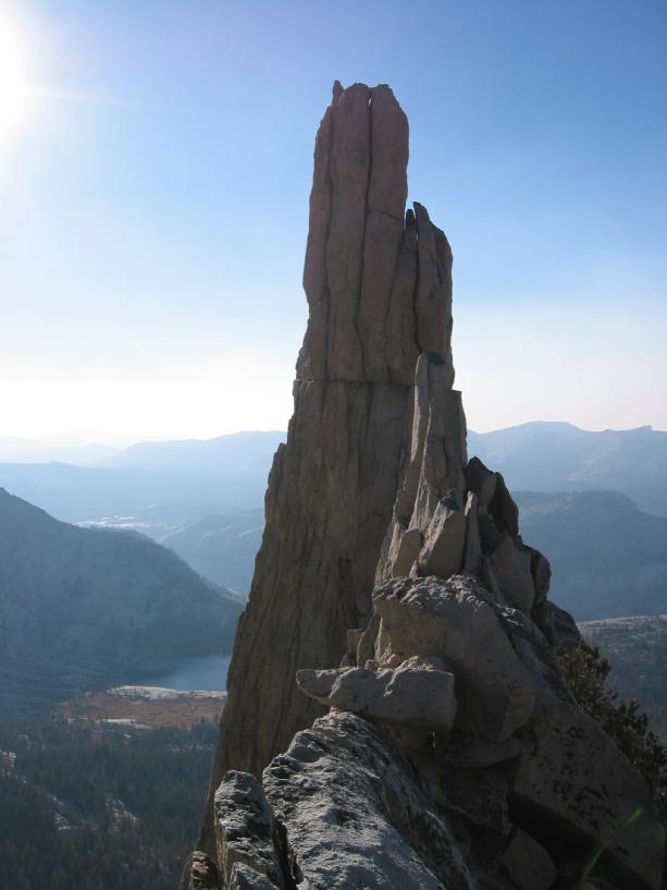
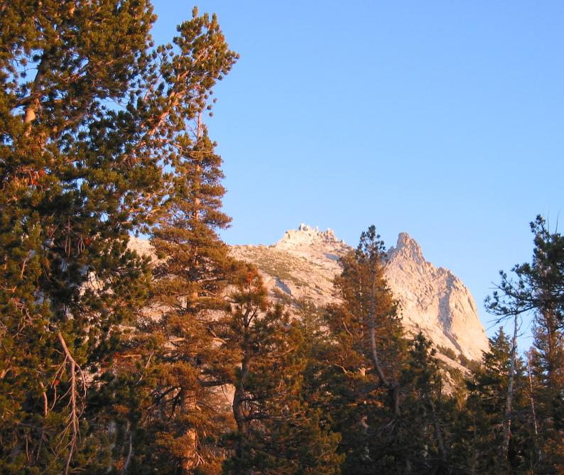
The trail basically consisted of a steep part at the beginning, followed by a short flat area, and then a long, steep part, followed by a long, mostly flat area. Then a short uphill to the lake. Throughout the hike, we could see a couple of domes and nice views off to our right. On our left, Cathedral Peak towered. From here, this looks like the peak, but it isn't. This is Eichorn Pinnacle, and the real peak is directly behind it. Essentially, we planned to do a loop around the peak, which turned out to be interesting, as it continually changed appearances as we walked around it. After the last uphill, we came to a meadow with the mountain behind and the lake in front of us.
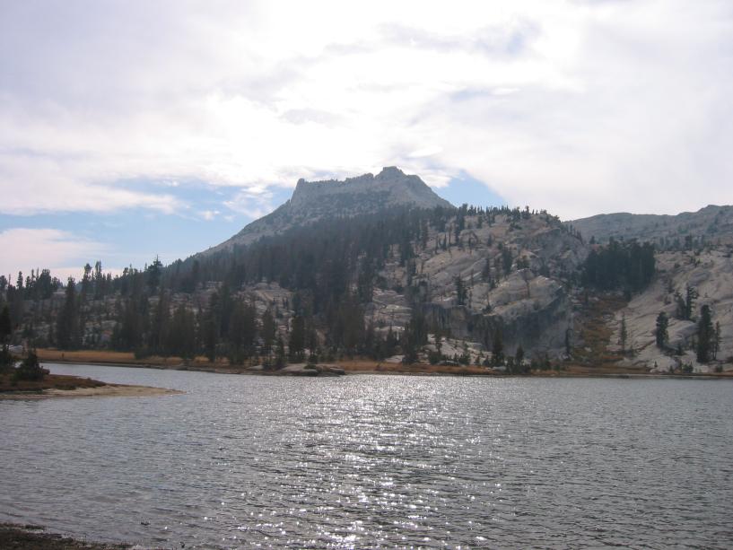
We arrived at the lake around 2:15. It was quite pretty, although very windy. Cathedral Peak towered above us. We'd been putting off lunch, so dug into it hungrily while we rested behind a rock on the edge of the lake. Shawn and I pawned off extra sandwiches, while Mike distributed some jerky.
After lunch, the plan was to head over the saddle to Budd Lake, at
which point we would split up, with some of us ascending the mountain
while others headed back. As we were heading toward the saddle, I
realized we were heading south instead of east, and the real saddle
was the formidable wall of granite to our left. At this point, Shawn
and Mia decided that they'd had enough and weren't about to climb that
cliff, let alone the whole mountain. They headed back to the car to wait for the rest of us who
would climb the saddle, and then hopefully Cathedral Peak.
Mike asked, "So where's the trail?"
"What trail?" Ryan replied.
"This dotted line on the map that goes up and over the saddle."
"Oh. I drew that."
"What?!?"
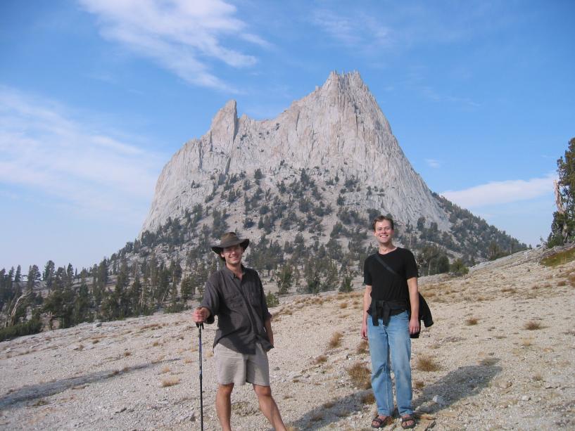
So we went bushwacking. Of course, it was mostly bare granite, so there wasn't much in the way of bushes to whack. It was mainly a matter of picking a line up the slope that wasn't too steep, and occasionally having to cross small gorges in the granite. As we climbed, the view got steadily better, and eventually we crested the saddle, which was very wide and flat on the top. The southeast buttress (on the right) of Cathedral Peak towered over us. The route that I'd been planning on (the Mountaineer's Route) up a scree slope to the peak looked steep, but doable. It was just around the corner from the southeast buttress. The view was great from the saddle, but a bit hazy to the south due to the smoke. On the other side of the saddle, we could see Budd Lake. It looked like there was a new fire over two or three ridges to the south.
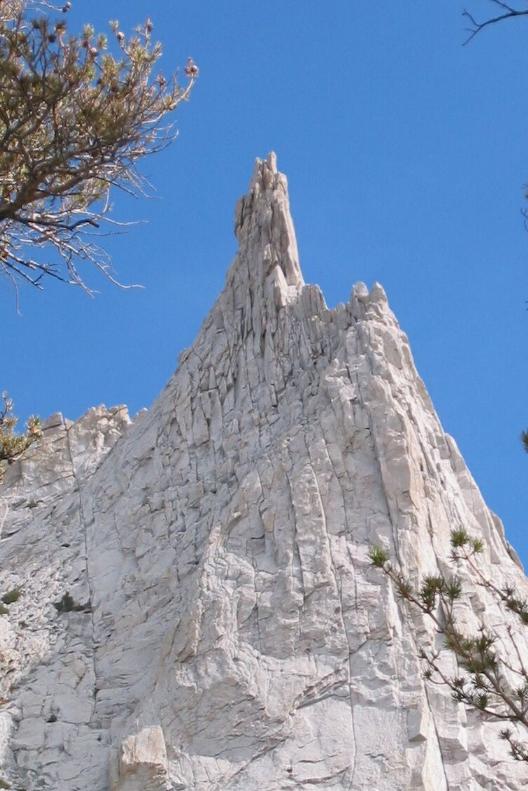
After a brief rest on the saddle, we headed up. The slope was steep, but walkable with only the occasional handhold for balance. It was dusty though, being a mixture of dirt and semi-solid scree. The going was slow, but after a brief dose of Cytomax, we gained the ridge. From there, we could see it was only a short distance over to Eichorn Pinnacle and from there to the summit.
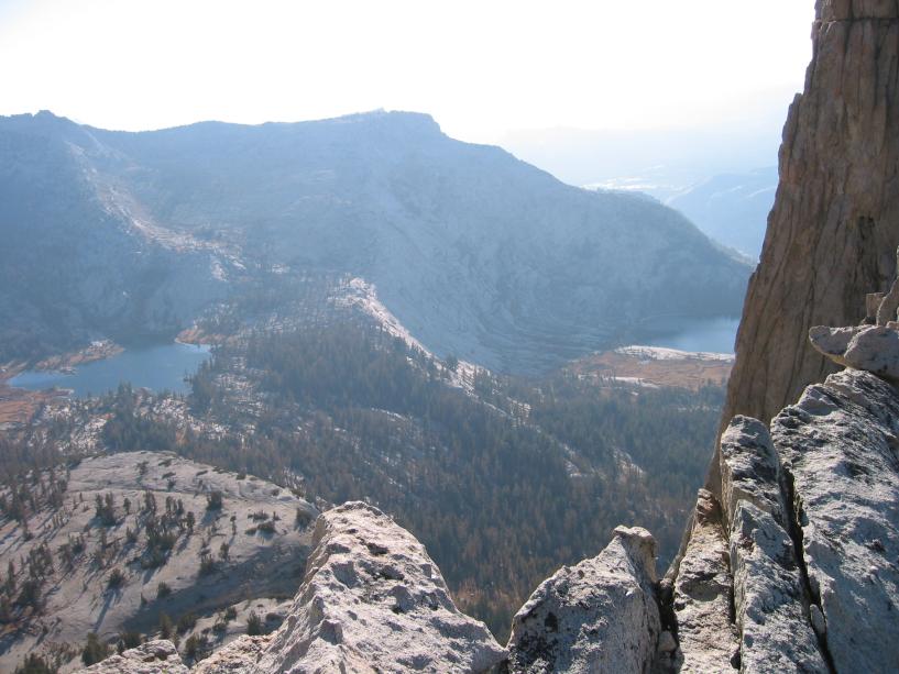
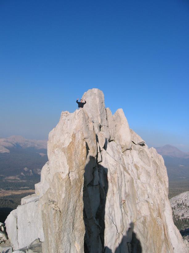
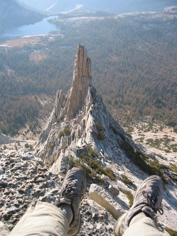
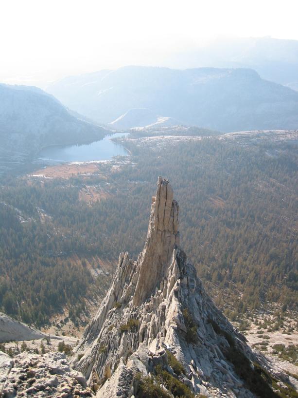
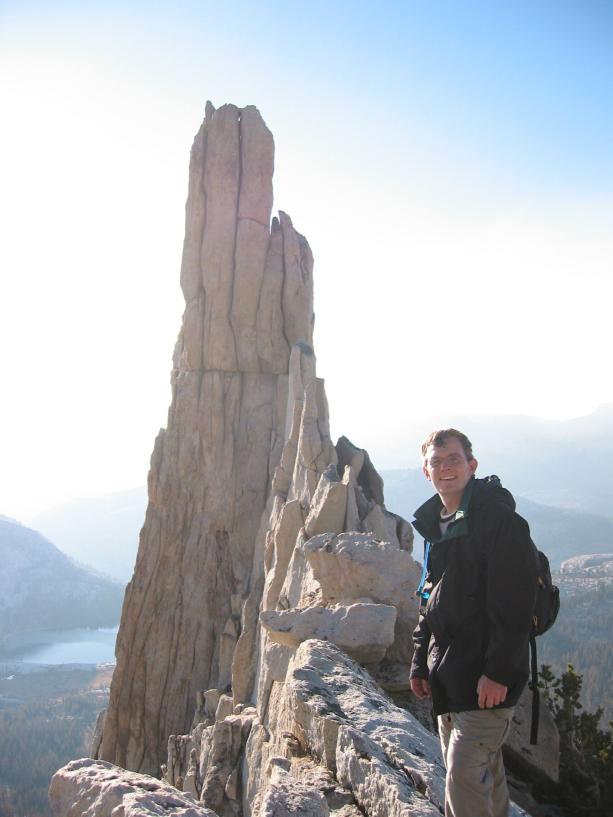
Shad decided not to make the hike to the summit, so Mike and I pressed on while he waited for us. As per our directions from someone else's trip report, we descended the other side of the ridge about 30 feet to a kind of ledge that we could use to traverse to the saddle between Eichorn and the peak. Another awesome view from there, with cliffs dropping straight down to the lake we'd been at a hour or so before, the lower Cathedral Lake, and a closeup view of Eichorn Pinnacle. At that point we had to climb over and around the various blocks on the narrow ridge to reach a set of summit blocks. The absolute summit block is very dicey without equipment, so we just climbed some of the lesser summit blocks near it. The smaller blocks were only about 2 feet by 2 feet, so you could sit straddling it, which was both fun and slightly vertigo inducing. These gave a new perspective on Eichorn, letting you know that you were significantly higher than it.
After some pictures we headed back down to the saddle, retrieved our packs, and rejoined Shad. From this point, the exact route was unclear, and the directions were vague. We descended roughly straight down the opposite side of the Mountaineer's Route, heading slightly north. This would not have been a good route if it was wet. After much slow and careful downclimbing, we reached the bottom and began a short hike through the forest to find the trail. It was a relief to be on roughly level ground again. Once we returned to the trail, we headed north, to the cars, at a fast walk. About 15 minutes after regaining the trail, the sun began to set. In a bit more than an hour, the twilight was getting dark, but we were almost at the trailhead. We reach the cars shortly after at 6:50.
On the way home, we stopped at the Iron Door for dinner, and managed to stick $2.50 to the ceiling.
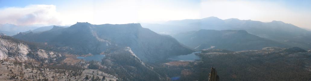
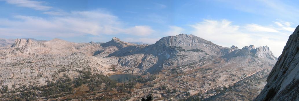
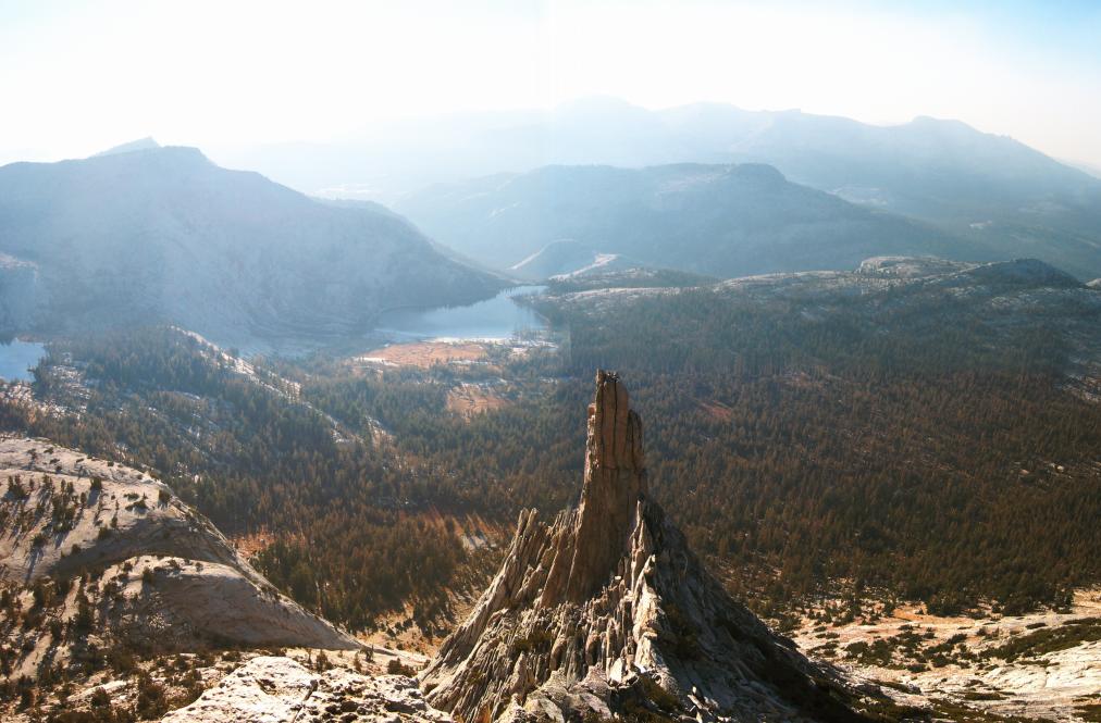
Here are some panoramic views, you'll probably have to scroll to see the whole picture:
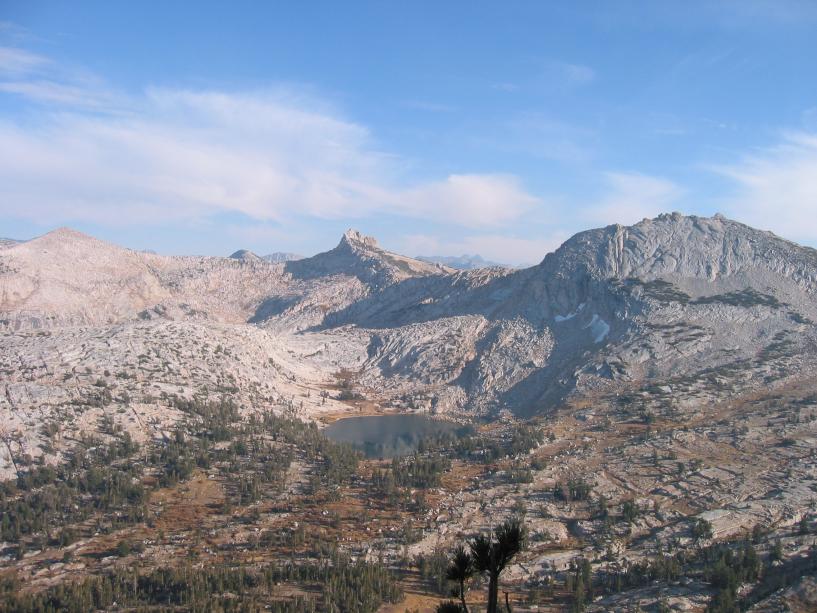
Cathedral Lakes
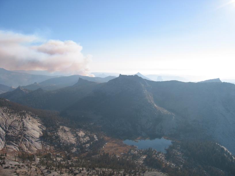
Budd Lake
Eichorn Pinnacle
Total distance: 7.3 / 7.8 miles
Total elevation gain: 1030 / 2370 feet
Maximum elevation: 9600 / 10940 feet
Time: 6:45 / 7:45 hours
Other trips